Booking and staying
Where to stay in Puerto Rico, region by region
San Juan, the east coast, the islands, the west, the south and the mountains: who each suits, drive times from SJU, and where to book a home direct.
For a first trip, stay in San Juan. In Old San Juan, Condado and Isla Verde the forts, the restaurants, the nightlife and a city beach are all a short ride apart. The airport is 18 minutes from Old San Juan. Then give whatever you came for a base of its own: Luquillo for El Yunque and the east-coast beaches, Dorado for golf and beaches west of the city, the west coast for surf and sunsets. Below, each of the island’s regions, as the Puerto Rico Tourism Company draws them, gets the same treatment: who it suits, how long the drive is, and where you can book a home in it.
Puerto Rico’s regions at a glance
The Puerto Rico Tourism Company groups all 78 of the island’s municipalities into seven regions, and this guide follows its map rather than drawing one of its own. San Juan and the towns around it are Porta Capital. The north coast west of the city is Porta Atlántico. The east, with El Yunque and the islands of Vieques and Culebra, is Porta del Mar. The west is split in two, Porta del Sol Norte and Porta del Sol Sur, the south coast is Porta Caribe, and the mountains in the middle are Porta Cordillera.
| Region | From SJU airport | Where to stay |
|---|---|---|
| San Juan and aroundPorta CapitalA first trip: the old city, restaurants, nightlife and city beaches, close to the airport | The airport is here, from Old San Juan | Book a home here |
| Dorado and the north coastPorta AtlánticoGolf and beaches at Dorado, then caves and limestone country further west |
| Book a home here |
| El Yunque, the east coast and the islandsPorta del MarThe rainforest, Luquillo Beach, a bio bay and the ferries to Vieques and Culebra |
| Book a home hereNot on Vieques or Culebra yet |
| Rincón and the northwestPorta del Sol NorteSurf, sunsets and a second airport, at Aguadilla |
| We don’t host here yetClosest: Dorado, to Rincón |
| Cabo Rojo and the southwestPorta del Sol SurCliffs, salt flats, a dry forest and the bio bay at La Parguera |
| We don’t host here yetClosest: Dorado, to Cabo Rojo |
| Ponce and the south coastPorta CaribePonce’s plaza and art museum, and the Caribbean side of the island |
| We don’t host here yetClosest: Condado, to Ponce |
| The mountainsPorta CordilleraMountain roads, coffee country and the island’s highest peak |
| We don’t host here yetClosest: Dorado, to Utuado |
By car, without traffic, rounded up to the minute. Regions and their municipalities: the Puerto Rico Tourism Company.
Times: our calculation on OpenStreetMap data, © OpenStreetMap contributors (ODbL)
Every drive here is by car, without traffic, worked out on OpenStreetMap’s roads the same way as our table of drive times around Puerto Rico, which has every drive from the airport, Old San Juan and each of our areas. Whether a region has homes to book is worked out from the homes themselves, so this table changes when they do.
San Juan and around (Porta Capital)
Porta Capital is San Juan and the towns around it: Carolina, Bayamón, Guaynabo, Cataño and Trujillo Alto, and further south Caguas, Gurabo, Cayey and Aguas Buenas. Most flights to Puerto Rico land here. Luis Muñoz Marín International (SJU), the island’s main gateway to the mainland United States, is in the Isla Verde district of Carolina.
Old San Juan
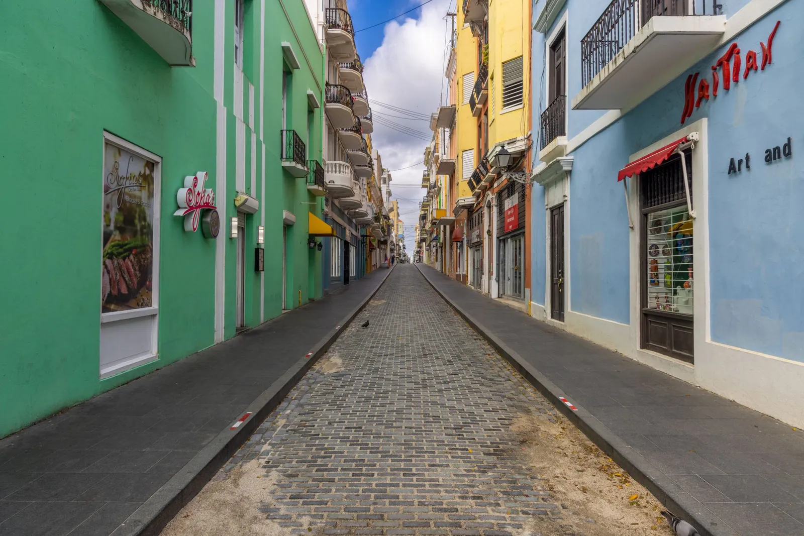
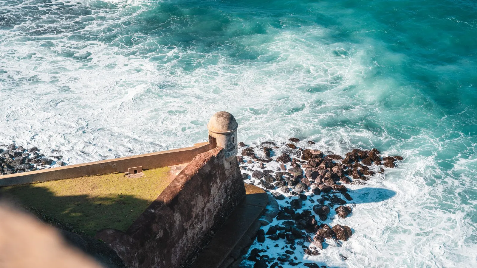
Old San Juan is the walled colonial city at the western end of San Juan Islet, between the Atlantic and San Juan Bay. Its two Spanish forts, Castillo San Felipe del Morro and Castillo San Cristóbal, are part of the San Juan National Historic Site, run by the National Park Service; with the city walls and La Fortaleza they have been on UNESCO’s World Heritage list since 1983. Stay here for history, restaurants and nightlife on foot, without a car. Its streets are narrow and cobbled, so a car is more trouble than help.
Condado, Ocean Park and Santurce
Condado is San Juan’s beachfront strip, with the Atlantic on one side, the Condado Lagoon on the other and Ashford Avenue’s restaurants in between. Ocean Park, the next beach east, is a beachfront residential district with small guest houses. Both sit in Santurce, San Juan’s largest district, home to two of the island’s major art museums, the murals of its yearly Santurce es Ley festival, and La Placita, a produce market by day and one of San Juan’s liveliest nights out after dark. All three suit a first trip that wants a beach without giving up the city.
Isla Verde and Carolina
Carolina, just east of San Juan, holds Isla Verde, the beachfront resort district beside the airport and, with Condado, one of the metro area’s main tourist areas. It is the practical base for a short trip or an early flight. The airport is from Isla Verde.
For the city in more detail, our guide to where to stay in San Juan, neighbourhood by neighbourhood compares its districts on beaches, noise and parking.
Dorado and the north coast (Porta Atlántico)
Porta Atlántico runs west from San Juan along the Atlantic: Toa Baja, Dorado, Vega Alta, Vega Baja, Manatí, Barceloneta, Arecibo, Hatillo and Camuy on the coast, with Toa Alta and Florida inland. Its eastern end is a short drive from the city. Further west the land turns to limestone, with rivers running underground through caves and sinkholes.
Dorado
Dorado has long been known for its golf, and its resorts and beaches line the coast west of San Juan. It suits families and groups who want space and quiet within reach of the city. Dorado is from the airport.
Karst country, from Arecibo to Camuy
Arecibo is from the airport. It sits where the coastal plain meets the island’s northern karst belt. Cueva del Indio, a seaside cave in its limestone cliffs, is named for the petroglyphs the Taíno carved there. The Arecibo radio telescope, the largest in the world until 2016, collapsed in December 2020.
Further west, the Río Camuy Cave Park takes visitors into a network of limestone caves and sinkholes carved by the Camuy River, one of the largest underground rivers in the world. The park has closed for long spells since the hurricanes of 2017 and 2022, so check that it is open before you plan a day around it. From Dorado, Camuy is .
El Yunque, Luquillo and the east (Porta del Mar)
Porta del Mar covers the east end of the island, from Loíza round the coast to Maunabo, with Canóvanas, Juncos, Las Piedras and San Lorenzo inland, and it takes in the islands of Vieques and Culebra. It holds El Yunque, the east-coast beaches and two of Puerto Rico’s three bioluminescent bays, and the ferries to the islands leave from its coast.
El Yunque
El Yunque National Forest is the only tropical rainforest in the US national forest system, and it spreads across eight municipalities of the northeast. Its recreation corridor is on PR-191 in Río Grande. The corridor’s El Portal visitor centre is from the airport. The Forest Service says entry to the corridor is free, needs no reservation and is open from 8 a.m. to 5 p.m., with parking only in marked areas. El Portal itself closes for two weeks every September for maintenance.
Rideshare apps may not pick up or drop off at the La Coca gate or at El Portal, and the Forest Service warns that visitors who arrive that way are often left walking for hours to get out. Come in your own car, a taxi or with a permitted tour operator.
Luquillo
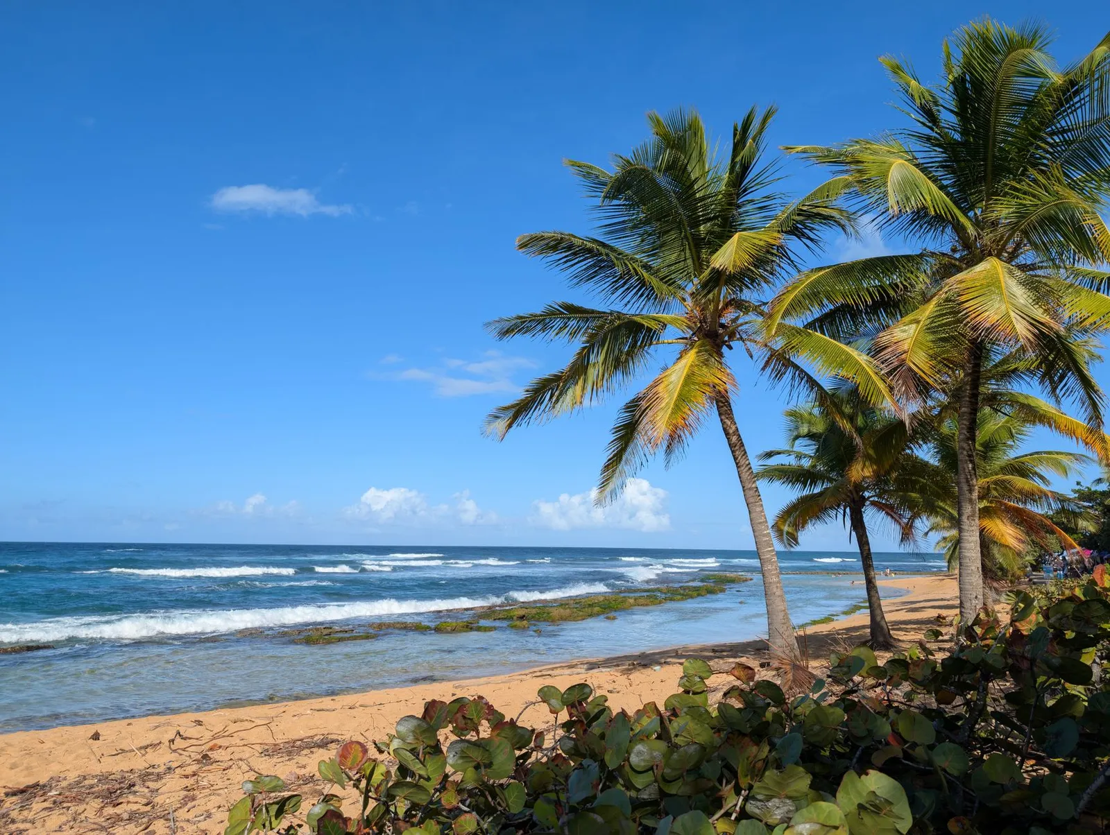
Luquillo sits between the Atlantic and El Yunque, which makes it the natural base for the forest. El Portal is from Luquillo. Its main public beach, Balneario La Monserrate, runs for about a mile under coconut palms, and the food kiosks beside it are a landmark of their own. Luquillo suits rainforest days, quieter beaches and anyone happy to drive. Our guide to the island’s beaches covers where the water is calm enough to swim.
Fajardo, Ceiba and a bay that glows
Fajardo is the hub of much of the island’s recreational boating. Its lagoon, Laguna Grande, is one of Puerto Rico’s three bioluminescent bays, where plankton light up when the water moves. Laguna Grande is from Luquillo. From the airport it is . Our bio bay guide explains why the moon decides what you see.
The ferries to Vieques and Culebra leave from Ceiba, south of Fajardo. The terminal is from Luquillo. From the airport it is .
The southeast, and Loíza
South of Ceiba the coast continues through Naguabo, Humacao, Yabucoa and Maunabo. Palmas del Mar, a resort community with golf courses, a beach club and a marina, is on Humacao’s coast. Humacao is from the airport.
At the other end of the region, just east of Carolina, Loíza is known for its Afro-Puerto Rican culture and its bomba music, and its Piñones district has open beaches, a mangrove forest and roadside food kiosks. Loíza is from the airport.
For a day or two in the forest itself, our El Yunque trail guide takes the trails one by one.
Vieques and Culebra
Vieques and Culebra are island municipalities off the east coast, both part of Porta del Mar, and no road reaches either. The public ferry crosses from Ceiba, and flights from SJU reach both islands’ airports, Vieques (VQS) and Culebra (CPX).
Vieques
1 hour by ferry from Ceiba
“A 1-hour ferry ride between Ceiba and Vieques.” — Puerto Rico Ferry, routes and schedules, checked
The drive to the Ceiba ferry terminal
- From SJU airport
- From Old San Juan
- From our homes in Luquillo
Isabel Segunda, where the ferry docks. Also on the island: Mosquito Bay (Vieques’ bio bay).
Culebra
1 hour 30 minutes by ferry from Ceiba
“A 1-hour-and-30-minute ferry ride between Ceiba and Culebra.” — Puerto Rico Ferry, routes and schedules, checked
The drive to the Ceiba ferry terminal
- From SJU airport
- From Old San Juan
- From our homes in Luquillo
Dewey, where the ferry docks. Also on the island: Flamenco Beach.
Rental cars stay on the mainland. The operator’s answer to whether a rental car can cross: “You may not purchase a vehicle ticket for a rental car.” — Puerto Rico Ferry, frequently asked questions, checked
Tickets are sold online, in the operator’s City Experiences app and at the terminals. The operator runs no route between the two islands, so seeing both by ferry means going back through Ceiba.
Vieques and Mosquito Bay
Vieques lies about 7 miles east of the main island. Large parts of both its ends are the Vieques National Wildlife Refuge, made from former Navy land in 2001 and 2003 and now the largest national wildlife refuge in the Caribbean; much of the eastern part is still closed to the public while unexploded ordnance is cleared. Mosquito Bay, near the village of Esperanza, is one of Puerto Rico’s three bioluminescent bays, and our bio bay guide covers which nights to go.
Culebra and Flamenco Beach
Culebra lies about 17 miles east of the main island. Flamenco Beach, on its northwest shore, curves for about a mile around a reef-sheltered bay of calm, shallow water and white sand. The peninsula beside it was used for military training until 1975, and Culebra’s wildlife refuge, set up in 1909, was the first federal reserve for native birds in the Caribbean.
Our guide to Vieques and Culebra covers the flights, the beaches and which island suits your trip.
Rincón and the northwest (Porta del Sol Norte)
Porta del Sol Norte is the island’s northwest corner: Isabela, Quebradillas, Aguadilla, Aguada, Rincón and Añasco on the coast, and Moca, San Sebastián, Lares and Las Marías in the hills behind them. It is surf country, it faces the sunset, and it has an airport of its own.
Rincón
Rincón, on the westernmost point of the main island, draws surfers from around the world. The 1968 World Surfing Championship was held at its Domes and Maria’s beaches, and its winter surf is some of the best in the region. Its tourism also runs on diving, snorkelling and sunsets, and its coast includes the Tres Palmas Marine Reserve. Rincón is from the airport. From Dorado it is .
Aguadilla and Isabela
Aguadilla, at the island’s northwest tip, has several beaches known for surfing, Crash Boat among them. Its airport, Rafael Hernández (BQN), was once Ramey Air Force Base and now has direct flights from several mainland US cities, so a trip that is mostly about the west can start here instead of San Juan. Isabela, next along the north coast, has Jobos Beach and a line of limestone cliffs.
Our advice: give the west at least two nights, or fly into Aguadilla and start the trip there.
Cabo Rojo and the southwest (Porta del Sol Sur)
Porta del Sol Sur is the southwest: Mayagüez, Cabo Rojo, Lajas, Guánica and Yauco on the coast, with San Germán, Sabana Grande, Hormigueros and Maricao behind them. It is the island’s corner of cliffs, salt flats and dry forest.
Cabo Rojo
Cabo Rojo holds the island’s southwestern tip, where the Los Morrillos lighthouse, finished in 1882, stands on white limestone cliffs above the sea. Beside it, the Cabo Rojo salt flats, where salt has been gathered since long before the Spanish arrived, are part of a national wildlife refuge, with trails, an observation tower over the pink lagoons and an interpretive centre on the history of the salt works. The area’s beaches include Playa Sucia and Boquerón. Cabo Rojo is from the airport.
La Parguera and Guánica
La Parguera, a village in Lajas, is where visitors go to see Bahía Fosforescente, the south coast’s bioluminescent bay, and its stretch of coast is scattered with small keys and islets. La Parguera is from the airport. East along the coast, the Guánica State Forest is a subtropical dry forest. UNESCO named it a biosphere reserve in 1981 and calls it the best example of dry forest in the world.
Mayagüez and coffee country
Mayagüez, the region’s city, is where the Ruta Panorámica begins: a chain of mountain roads that crosses the island along the Cordillera Central to Maunabo on the southeast coast. Yauco is one of the island’s main coffee towns, and its coffee festival is the oldest on the island.
Like the northwest, this corner is a trip of its own. Cabo Rojo, Boquerón and La Parguera all make a base for a few nights.
Ponce and the south coast (Porta Caribe)
Porta Caribe is the Caribbean side of the island, from Guayanilla and Peñuelas in the west through Ponce, Juana Díaz, Santa Isabel, Salinas and Guayama to Arroyo and Patillas in the east, with Coamo and Villalba inland.
Ponce
Ponce, founded in 1692, is the most populated city outside the San Juan metro area. Its centre is the Plaza Las Delicias, where the red-and-black Parque de Bombas, built for an exhibition in 1882 and later Puerto Rico’s first fire station, is now a museum. The Museo de Arte de Ponce, on Avenida Las Américas, is the largest art museum in the Caribbean and holds one of the most important Pre-Raphaelite collections in the Western Hemisphere.
Ponce is from the San Juan airport. Its own airport, Mercedita (PSE), has direct flights from Florida.
The rest of the south coast
East of Ponce the coast runs through Santa Isabel, Salinas and Guayama, and inland, Coamo is known for its hot springs, Los Baños de Coamo. Salinas is from the airport. Ponce works as an overnight from San Juan, or as a stop between the city and the southwest.
The mountains (Porta Cordillera)
Porta Cordillera is the island’s mountainous middle: Utuado, Jayuya, Adjuntas, Ciales, Morovis, Orocovis, Barranquitas, Aibonito, Naranjito, Corozal, Comerío and Cidra. None of them is on the coast.
The Cordillera Central runs through the region. Its highest peak, Cerro de Punta, rises to 1,338 metres (4,390 feet) on the line between Jayuya and Ponce, inside the Toro Negro State Forest, and is reached from PR-143. The Ruta Panorámica follows the range, mostly on PR-105, PR-143 and PR-182, and it is the way to see the interior.
Coffee grows in these hills. Adjuntas is one of the main coffee towns, with Lares, Las Marías and San Sebastián to the west and Yauco to the south, and Utuado was the island’s leading coffee town before 1898. In Utuado, the Caguana Indigenous Ceremonial Park keeps Taíno ball courts and stones carved with petroglyphs, about seven centuries old: one of the largest and most important pre-Columbian sites in the West Indies.
Utuado is from the airport. From Dorado it is , which puts the mountains within a day trip of the north coast. The mountain roads are secondary roads, so allow more time than the figures here suggest.
One base or two?
Most trips work best with San Juan as the first base and one more near whatever the trip is really about. As a rule of thumb:
- A long weekend: stay in San Juan and take the east as day trips. El Yunque is from the airport. Luquillo Beach is from the airport.
- A week: split it, four nights in the city and three near what you came for: Luquillo for the rainforest and the east, Dorado for golf and beaches near the city, the west for surf. Our seven-day itinerary plans that week day by day.
- The west or the south: treat each as a leg of its own, two nights at least. Rincón is from the airport, and a day trip means driving that twice.
- Vieques or Culebra: give the island at least two nights, and plan the days around the ferry timetable.
Every figure in this guide is by car without traffic, rounded up to the minute.
Getting around the island
- A car, outside San Juan. In Old San Juan and around Condado you can manage on foot, by taxi and with rideshare. The metropolitan bus authority, the AMA, serves the San Juan metropolitan area: San Juan, Bayamón, Carolina, Cataño, Guaynabo and Trujillo Alto, with Levittown in Toa Baja and Loíza by way of Piñones. Most towns have shared vans called públicos, which leave from a terminal near the central plaza. For El Yunque, the west, the south and the mountains, a car is the practical choice.
- Tolls are electronic. Most of the island’s toll motorways take only AutoExpreso, an electronic tag, not cash, and it does not work with E-ZPass or SunPass. Ask the rental desk how the car’s tag is billed; our cost guide covers the rest of a car’s running costs.
- No rideshare at El Yunque’s gates. The Forest Service does not allow rideshare pick-ups or drop-offs at the La Coca gate or at El Portal.
- No rental cars on the ferries. The ferry operator does not sell vehicle tickets for rental cars, so the car stays on the main island.
- Three airports with mainland flights. SJU takes most of them, but Aguadilla (BQN) and Ponce (PSE) have direct flights from the mainland too, which can save the long drive to the west or the south.
- Traffic is not in the figures. Allow extra time on weekday mornings and late afternoons in and around San Juan, and more on a Friday evening heading out of the city.
When you know the region, every home we have is on one page, and you can narrow it down by area and by your dates.
Sources
Each fact above comes from the source listed here, read on the date given. The drives are our own calculation.
Read on , unless another date is given.
- Puerto Rico Tourism Company, Regions. The regions and the municipalities in each.
- OpenStreetMap contributors (ODbL), The road map of Puerto Rico, routed by us. Every drive time on this page, by car without traffic; how they are worked out is on our drive-time table.
- US Census Bureau, TIGERweb municipio boundaries. Which municipality, and so which region, each home on this site is in, and which municipalities reach the coast.
- US Forest Service, El Yunque National Forest. The only tropical rainforest in the national forest system, across eight municipalities.
- US Forest Service, El Yunque: current conditions (updated February 27, 2026). Free entry to the PR-191 corridor with no reservation, its hours and parking; no rideshare pick-ups or drop-offs at the La Coca gate or El Portal.
- US Forest Service, El Portal Rainforest Center annual closure. El Portal closes for two weeks every September.
- National Park Service, San Juan National Historic Site. The site’s forts, El Morro and San Cristóbal, run by the National Park Service.
- UNESCO World Heritage Centre, La Fortaleza and San Juan National Historic Site in Puerto Rico. On the World Heritage list since 1983: La Fortaleza, the forts of El Morro, San Cristóbal and El Cañuelo, and most of the old city wall. Read .
- Puerto Rico Ferry, Routes and schedules. The crossings from Ceiba to Vieques and to Culebra, and the operator’s routes.
- Puerto Rico Ferry, Frequently asked questions. Where tickets are sold, the routes sold, and no vehicle tickets for rental cars.
- US Fish and Wildlife Service, Vieques National Wildlife Refuge. How far Vieques is from the main island; the refuge made from former Navy land, the largest in the Caribbean, and the eastern area still closed.
- US Fish and Wildlife Service, Culebra National Wildlife Refuge. How far Culebra is from the main island; the refuge since 1909; military training on the Flamenco Peninsula until 1975.
- Discover Puerto Rico, the island’s official destination marketing organisation, Puerto Rico’s Bio Bays. The island’s three bioluminescent bays, Mosquito Bay in Vieques, Laguna Grande in Fajardo and La Parguera in Lajas, where plankton glow when the water moves. Read .
- US National Science Foundation, Arecibo Observatory media toolkit. The collapse of the observatory’s 305-metre telescope on December 1, 2020. Read .
- US Fish and Wildlife Service, Cabo Rojo National Wildlife Refuge. The salt flats: trails, an observation tower, an interpretive centre on their history, the pink lagoons.
- UNESCO Man and the Biosphere Programme, Guanica biosphere reserve. A biosphere reserve since 1981, and the best example of dry forest in the world. Read .
- Puerto Rico Department of Natural and Environmental Resources (DRNA), Bosque Estatal de Guánica, fact sheet P-034 (November 2008). The state forest on the southwest coast, a subtropical dry forest, named an international biosphere reserve in 1981. Read .
- Puerto Rico Department of Natural and Environmental Resources (DRNA), Bosque Estatal de Toro Negro, fact sheet P-030 (July 2008). Cerro de Punta, 1,338 metres, the island’s highest peak, inside the Toro Negro State Forest. Read .
- Puerto Rico Department of Transportation and Public Works (DTOP), Autoridad Metropolitana de Autobuses. The AMA’s buses serve the San Juan metropolitan area: Bayamón, Carolina, Cataño, Guaynabo, Levittown (Toa Baja), Loíza by way of Piñones, San Juan and Trujillo Alto. Read .
Wikipedia articles checked for the details
- Old San Juan: The walled city on San Juan Islet, between the Atlantic and San Juan Bay, and its narrow cobbled streets.
- Condado (Santurce): The beachfront district on Ashford Avenue, between the Atlantic and the Condado Lagoon, in Santurce.
- Ocean Park (Santurce): A beachfront residential district in Santurce, with small guest houses.
- Santurce, San Juan, Puerto Rico: San Juan’s largest district, its two major art museums and the Santurce es Ley murals.
- La Placita de Santurce: A produce market by day and one of San Juan’s liveliest nightlife districts.
- Isla Verde, Puerto Rico: The beachfront resort district beside the airport; with Condado, one of the main tourist areas.
- Luis Muñoz Marín International Airport: SJU is in Isla Verde, Carolina, and is the main gateway to the mainland; its flights to Vieques and Culebra.
- List of airports in Puerto Rico: The airports and their codes, and how much traffic each carries.
- Rafael Hernández Airport: BQN was once Ramey Air Force Base; its direct flights from mainland US cities.
- Mercedita International Airport: PSE’s direct flights from Florida.
- Flamenco Beach: The beach and its reef-sheltered bay.
- Puerto Mosquito: Mosquito Bay on Vieques, near the village of Esperanza.
- Luquillo, Puerto Rico: Balneario La Monserrate, a mile of beach under coconut palms, and the kiosks beside it.
- Fajardo, Puerto Rico: Fajardo as the hub of recreational boating; Laguna Grande.
- Loíza, Puerto Rico: Afro-Puerto Rican culture and bomba; Piñones.
- Palmas del Mar: The resort community on Humacao’s coast.
- Dorado, Puerto Rico: Dorado’s golf, its resorts and its beaches.
- Arecibo, Puerto Rico: The northern karst belt, and the telescope, the largest radio telescope in the world until 2016.
- Cueva del Indio (Arecibo): A seaside cave in the limestone cliffs, a nature reserve, named for the petroglyphs the Taíno carved there. Read .
- Parque Nacional de las Cavernas del Río Camuy: The cave park and its river, and its closures after the 2017 and 2022 hurricanes.
- Rincón, Puerto Rico: Rincón’s surf and the 1968 World Surfing Championship; diving, snorkelling and sunsets; Tres Palmas.
- Aguadilla, Puerto Rico: Its surfing beaches, Crash Boat among them.
- Isabela, Puerto Rico: Jobos Beach and the limestone cliffs of its coast.
- Cabo Rojo National Wildlife Refuge: Salt gathered at the salt flats since about 700 CE.
- Cabo Rojo, Puerto Rico: Its beaches, Playa Sucia and Boquerón among them.
- Faro Los Morrillos de Cabo Rojo: The lighthouse, finished in 1882, on limestone cliffs at the southwestern tip.
- Lajas, Puerto Rico: La Parguera, Bahía Fosforescente and its keys.
- Ruta Panorámica: The mountain route from Mayagüez to Maunabo, mostly on PR-105, PR-143 and PR-182.
- Coffee production in Puerto Rico: The main coffee towns, Yauco’s festival and Utuado’s past.
- Ponce, Puerto Rico: Ponce’s founding and its size outside the San Juan metro area.
- Parque de Bombas: The 1882 building on Plaza Las Delicias, Puerto Rico’s first fire station, now a museum.
- Museo de Arte de Ponce: The largest art museum in the Caribbean and its Pre-Raphaelite collection.
- Coamo, Puerto Rico: Los Baños de Coamo, its hot springs.
- Cerro de Punta: Where the peak stands, on the line between Jayuya and Ponce, and the road to it, PR-143.
- Caguana Ceremonial Ball Courts Site: The Taíno ball courts and petroglyphs in Utuado.
- Transportation in Puerto Rico: Públicos in most towns, leaving from a terminal near the central plaza.
- AutoExpreso: Electronic tolls, no cash, and no E-ZPass or SunPass.
Common questions
Where should I stay in Puerto Rico for the first time?
In San Juan. Old San Juan puts the forts, the restaurants and the nightlife within walking distance, and Condado and Isla Verde put the beach at the end of the street. The airport is 18 minutes from Old San Juan without traffic. If one thing beyond the city is the reason for the trip, add a second base near it: Luquillo for El Yunque, Dorado for golf and beaches, or the west coast for surf.
Where should I stay in Puerto Rico without a car?
Old San Juan or Condado. Both are walkable, with restaurants and sights within reach on foot, and in Condado the beach too; taxis and rideshare fill the gaps around the city. Outside San Juan you need a car: the metropolitan buses serve the San Juan metropolitan area, and rideshare apps may not pick up or drop off at El Yunque’s La Coca gate or its El Portal visitor centre.
Where should I stay to visit El Yunque?
On the northeast coast, in Luquillo or in Río Grande, where the forest’s recreation corridor is. The El Portal visitor centre is 15 minutes from Luquillo by car. According to the US Forest Service, entry to the corridor on PR-191 is free, needs no reservation and runs from 8 a.m. to 5 p.m. Drive yourself or take a taxi: rideshare apps may not pick up or drop off at the La Coca gate or El Portal.
How far is Rincón from San Juan?
By car, without traffic, Rincón is 2 hours 10 minutes from the San Juan airport and 2 hours 7 minutes from Old San Juan. Aguadilla’s airport (BQN) is far closer to Rincón and has direct flights from several mainland US cities, so for a trip that is mostly about the west it is often the easier way in.
Can I take a rental car to Vieques or Culebra?
No. The ferry operator, Puerto Rico Ferry, does not sell vehicle tickets for rental cars. Drive to the Ceiba ferry terminal, 1 hour 9 minutes from the airport without traffic, and cross as a foot passenger: the ferry takes about 1 hour to Vieques and about 1 hour 30 minutes to Culebra, by the operator’s own figures. Flights from SJU also reach both islands.
Where to stay
Homes near everything in this guide
Keep reading